Zastoji
Slovenia's roads, live. Jams, closures, roadworks, cameras, border queues, travel times and fuel prices on one map, then filtered down to the roads you actually drive.
Drag through the appDrag through the app
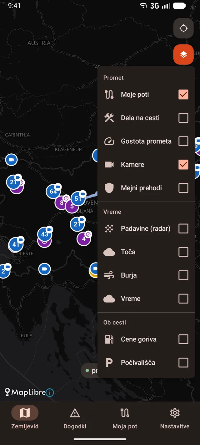
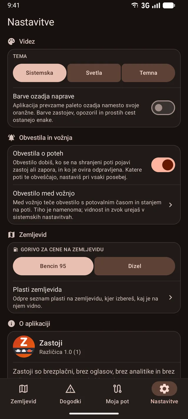
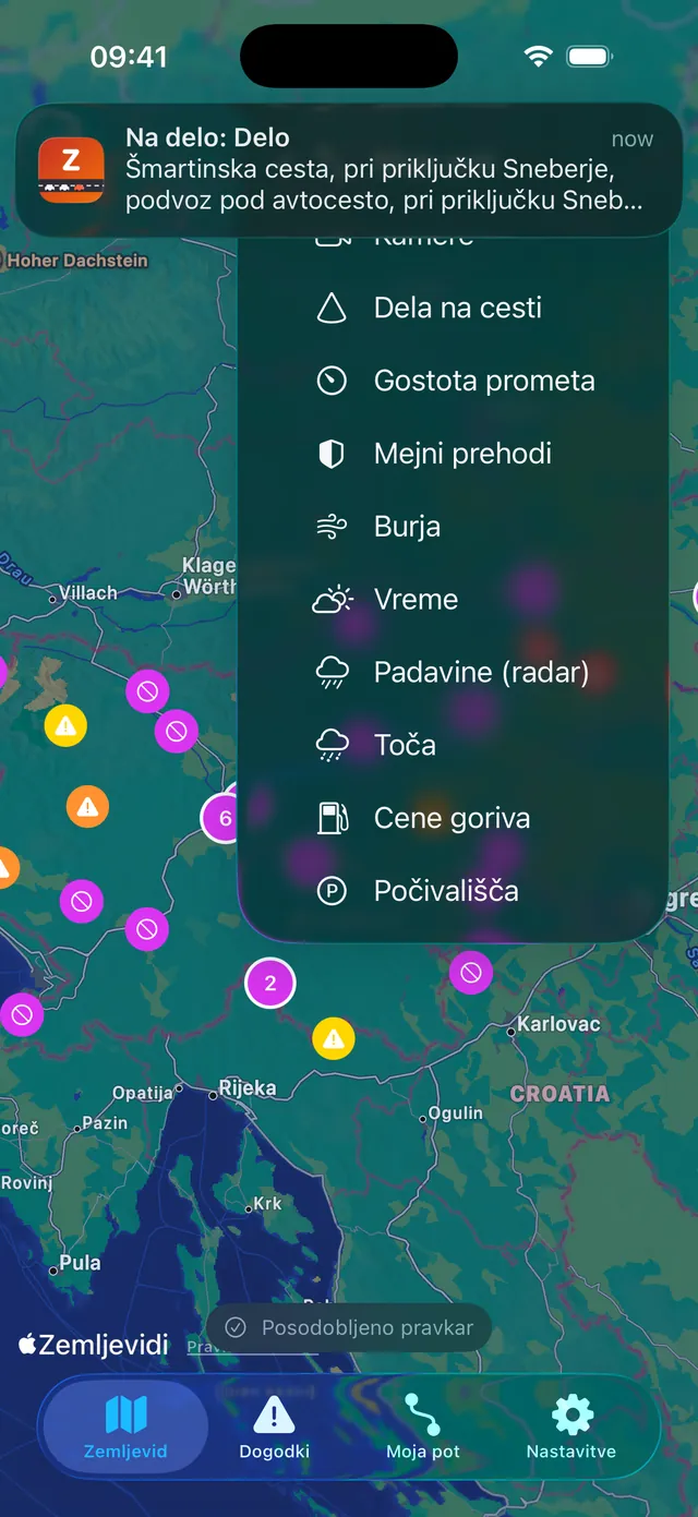
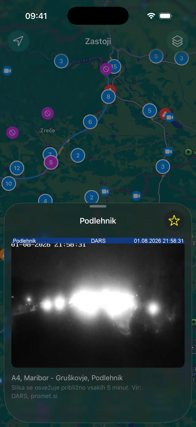
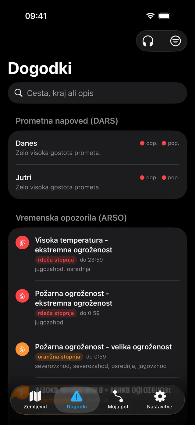
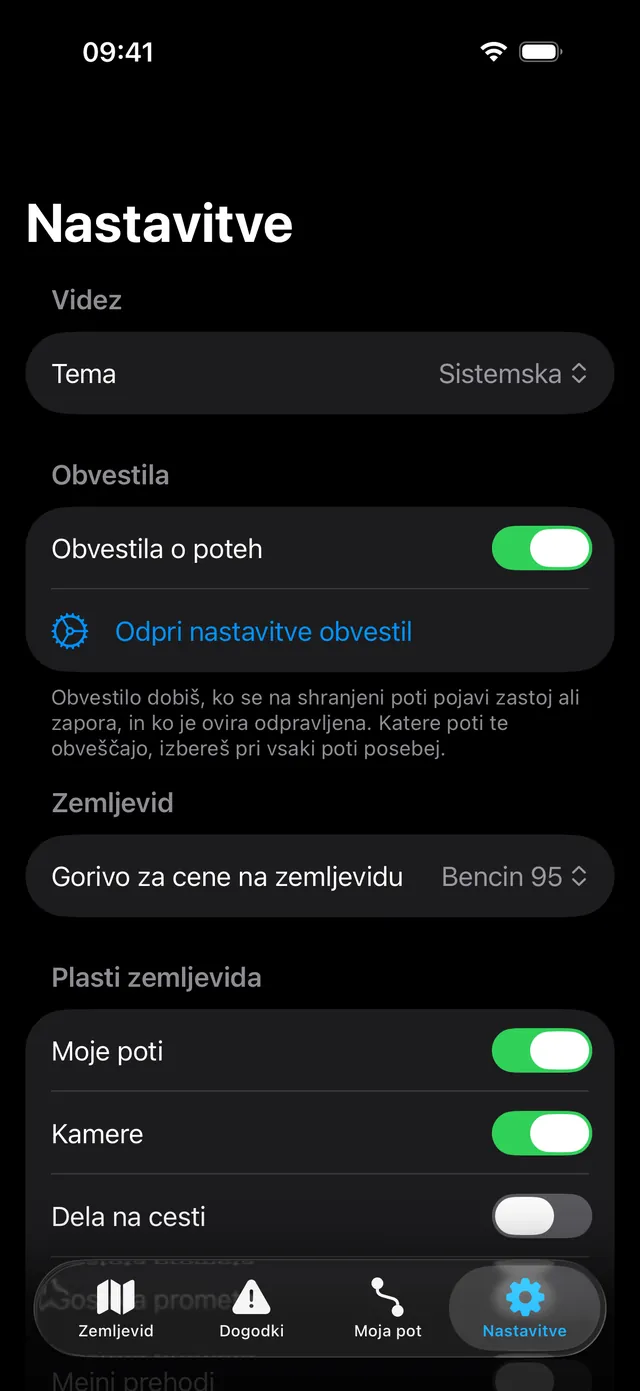
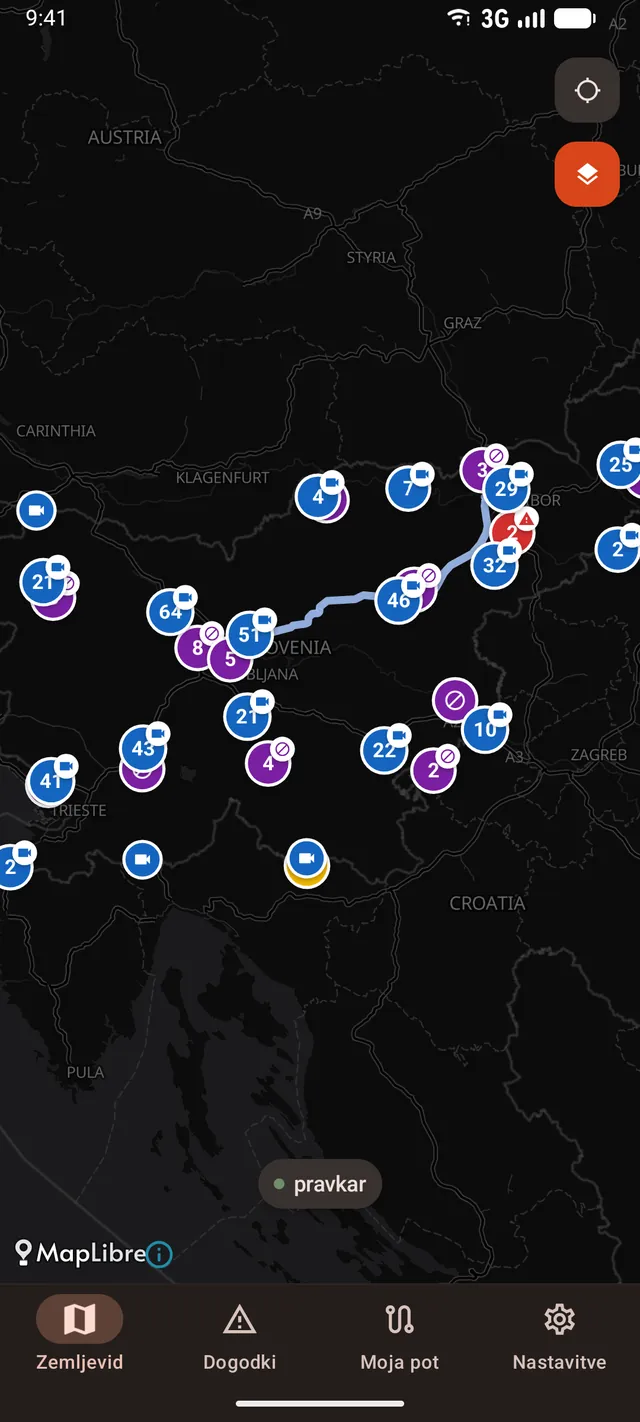
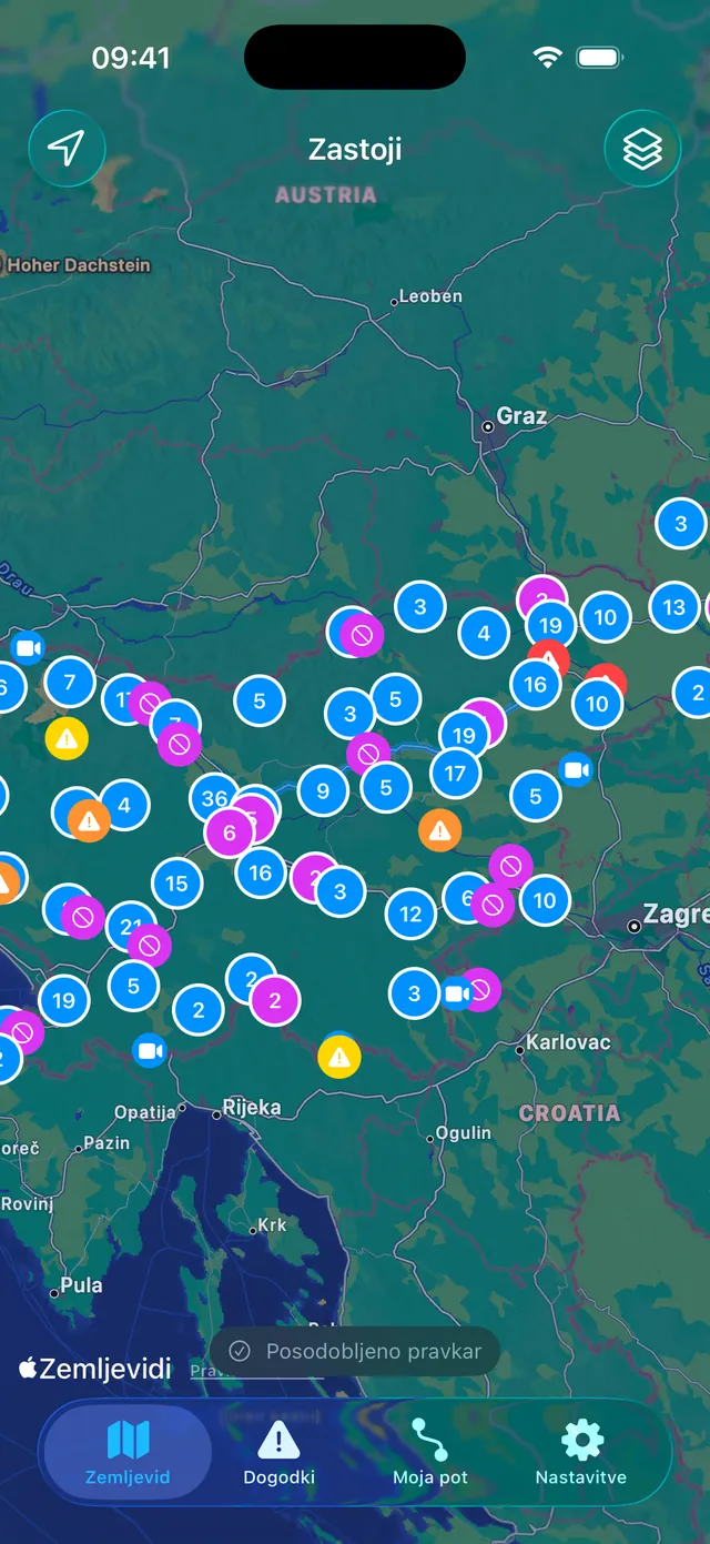
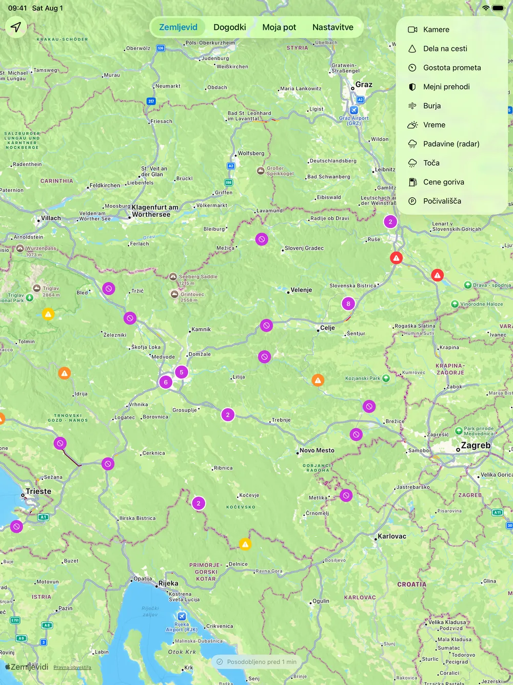
One map, twelve layers
Traffic events are always drawn. Everything else is a switch, and every switch is remembered. Zastoji is an independent app: it is not an official DARS or promet.si product, and the interface is in Slovenian.
Live incidents and closures
Jams, accidents, obstacles, carriageway closures and roadworks, clustered on the map and searchable as a list, sorted by how much they actually matter.
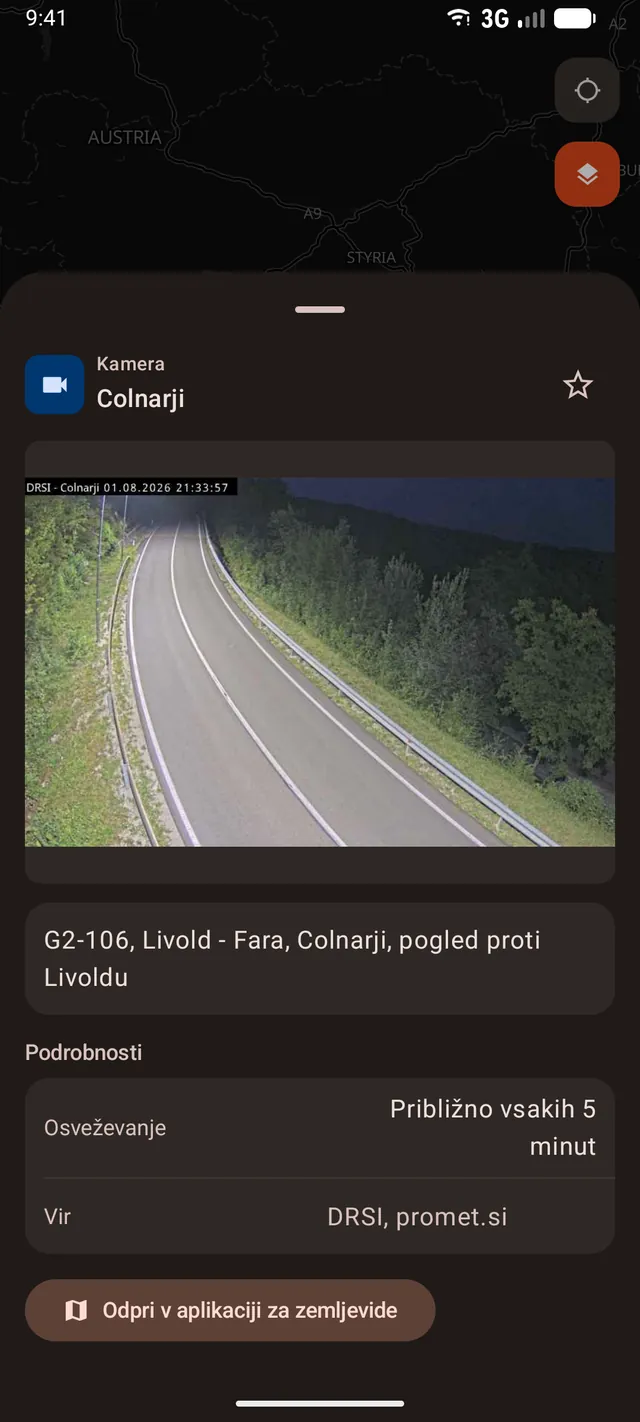
536 traffic cameras
Every public DARS and promet.si camera, grid-clustered on the map with a live still in the detail sheet. Save the ones on your commute as favourites.
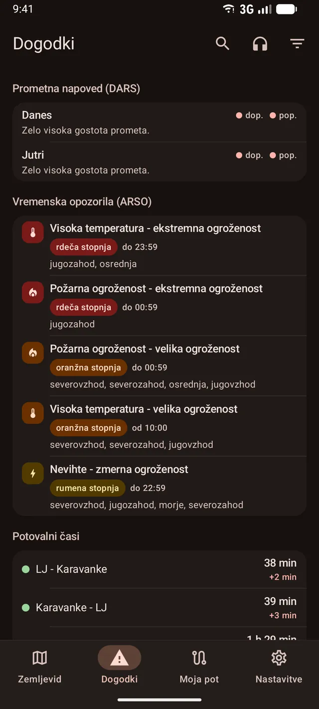
Travel times, now against normal
DARS motorway segments with trend arrows, and a chart comparing today with a typical same weekday, school break or holiday.
Border queues
Waiting notices per crossing, plus a chart of the usual queues so you can pick a better hour to cross.
Weather that closes roads
ARSO and MeteoAlarm warnings, bora wind stations with gust badges, road weather stations, rain radar and a hail nowcast.
Fuel prices and rest areas
Petrol stations coloured by price quartile with a 95 or diesel switch, and 66 rest areas with amenities and live truck-parking occupancy.
The traffic report, read aloud
The promet.si report with its spoken version behind one button, so you can listen instead of reading before you set off.
Honest about its own data
Every screen states how old the data is. Stale or offline data is labelled rather than quietly presented as live, and radar frames older than 15 minutes disappear instead of posing as current.
Only the roads you drive
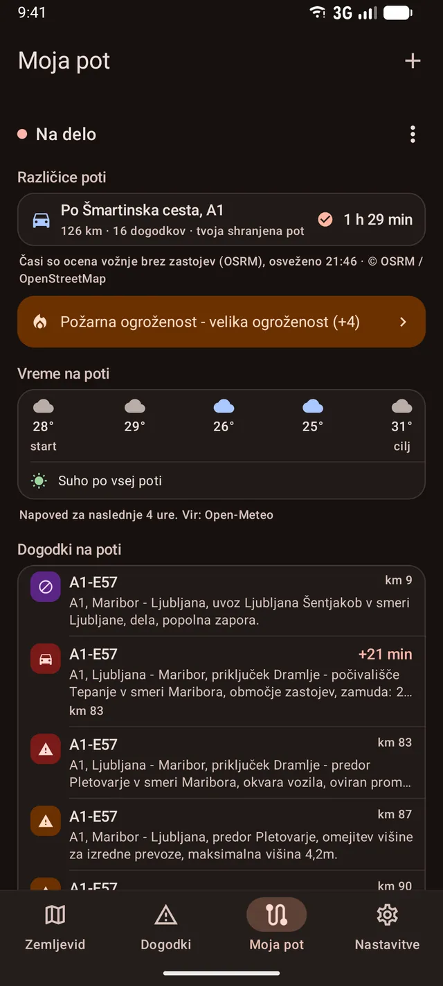
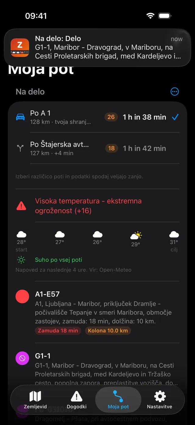
Save an A to B route and Zastoji matches everything against its corridor: incidents split into the ones on your roads and the ones merely nearby, weather chips, a five-point weather strip, cameras in order along the way, and rest areas with their distance from the start. Routes are searched with Photon and computed with OSRM.
Save an A to B route and Zastoji matches everything against its corridor: live Apple ETA with up to three alternatives, each carrying its own matched incident count, weather chips, a five-point weather strip, cameras in order along the way, and rest areas with their distance from the start.
Route alerts
A background pass notifies you when a jam or carriageway closure appears on a saved route, and again when it clears. The "Moja pot" home-screen widget carries the same status: severity dot, travel time, delay badge, worst event and a staleness footer.
A background refresh notifies you when a jam or carriageway closure appears on a saved route, and again when it clears, at most three alerts per route per pass. The home-screen widget refetches on its own when its stored summary is older than three minutes.
On the drive
On the drive
"Začni vožnjo" opens an immersive drive screen backed by an ongoing notification with travel time, delay and the worst event on the way. A launcher shortcut jumps straight to your routes.
A "Vožnja" Live Activity carries delay, worst event and travel time on the Lock Screen and in the Dynamic Island, and survives a relaunch mid-drive. An App Shortcut answers "Stanje na mojih poteh" from Siri, Spotlight or the Action button.
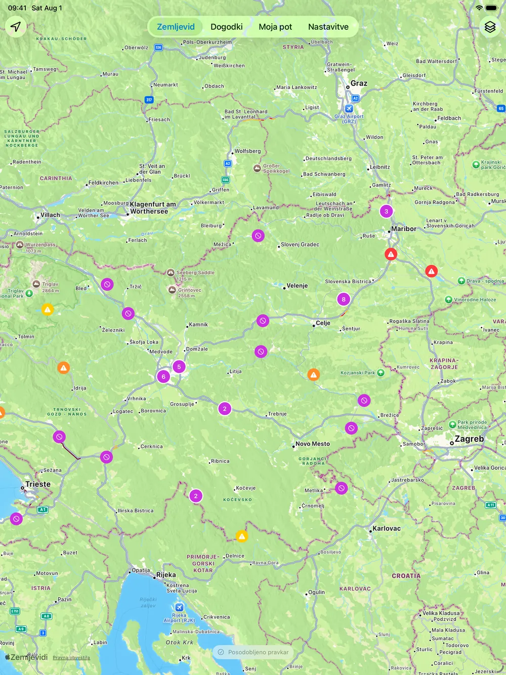
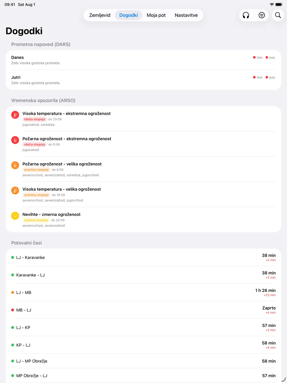
The whole country on iPad
The iOS build targets iPad alongside iPhone. The tabs move to the top, the map gets the full slate, and the event list stops making you scroll for the thing you came to check. The screenshots below come from a 13-inch iPad Air.
Data and privacy
Zastoji has no accounts and no analytics. Saved routes, favourite cameras and every setting stay on your device. Traffic data comes from one endpoint, a 2MAD Labs Cloudflare Worker that normalizes the public sources below into a single JSON feed, and a request sends only what that feature needs. Location is optional and used in the foreground only, for the "nearby" filter and the next rest area ahead.
Read the full Zastoji privacy policy.
Details
- Requires
- Android 10 or neweriOS 18 or newer
- Availability
- Coming soon to Google PlayComing soon to the App Store
- Version
- 1.0
- Languages
- Slovenian
- Devices
- Phone, with a home-screen widgetiPhone and iPad, with widgets and a Live Activity
- Permissions
- Notifications and location (both optional)
- Built with
- Kotlin · Jetpack Compose · MapLibreSwift · SwiftUI · MapKit
Data sources and licences
Zastoji brings together open traffic and weather data from public providers. It is an independent app and is not affiliated with, or endorsed by, the providers below. In line with their terms, here is where each kind of data comes from.
Processing: Zastoji reshapes, combines, caches, ranks and interprets the data above to match it to your routes, to grade severity, and to build its "now against normal" comparisons. Any such interpretation is the app's own and is not provided or endorsed by the data sources.
Data disclaimer
Zastoji is an informational traffic app. It is not an official traffic-information, emergency, rescue, navigation or safety service, and it is not a substitute for road signs, police instructions or official DARS publications.
The app uses third-party data sources such as DARS, promet.si, ARSO, MeteoAlarm, Open-Meteo and goriva.si. Those sources can be delayed, incomplete, unavailable, changed without notice, or wrong. Zastoji also transforms, combines, caches, ranks and interprets that data. Mistakes can happen because of provider errors, network issues, stale cached data, route-matching mismatches, model assumptions, software bugs, or an incorrect interpretation of otherwise valid data.
Zastoji and 2MAD Labs cannot guarantee that any displayed incident, travel time, queue estimate, price, occupancy figure or warning is accurate, complete, current, or suitable for your situation.
Never operate the app while driving. Check conditions before you set off, follow the road signs and the instructions of the authorities, and treat the official source as the more important one whenever information conflicts.
Know the road,
before you take it.
Free, no ads, no tracking, no accounts. Bug reports and feature ideas are always welcome.